
September 8, 2026
What is a catchment area? Definition, methods and how to measure it
A catchment area is the geography a location draws its visitors from. How it is defined depends on how it is measured: a radius, a travel-time boundary, or observed mobility.

Izabela Szymczyk · Software Developer, Pine59
Understanding the geographic reach of a location is not simply a question of distance. Accessibility, transport networks, surrounding destinations, and everyday movement patterns all influence where visitors come from and how far a location's reach extends.
Catchment area analysis provides a way to describe and measure that relationship. Depending on the method, a catchment can represent anything from an estimated radius or travel-time boundary to the areas that visitors are attracted from.
What is a catchment area?
A catchment area is the geographic area from which a physical location attracts its visitors. It describes the relationship between a point of interest (POI) and the resident or work areas of its visitors.
Catchments can vary significantly even between locations that are geographically close. A location next to a major transport corridor may attract visitors from a wider area, while another nearby location may have a much more local pattern.
Several factors shape this reach. Location type influences how far people are willing to travel, while roads, public transport, geographic barriers, and surrounding alternatives affect accessibility and visitor choice. Urban and rural locations may also show very different patterns because of differences in population density, transport options, and typical travel distances. Daily routines, such as commuting and workplace visits, can further extend a catchment beyond residential areas.
For this reason, how a catchment area is defined depends largely on how it is measured.
Catchment area vs. trade area
Catchment area and trade area describe closely related concepts and are often used interchangeably.
Catchment area is the broader term for the geography from which a location attracts visitors. Trade area is particularly common in commercial and location-based analysis, where the focus is on visitor origins and market reach.
At Pine59, Trade Area refers to the dataset used to understand visitor origins based on mobility patterns.
Why catchment areas matter
Catchment area analysis helps connect a physical location with the geographic patterns behind its visitation. It can support decisions such as:
- Location and site planning: understand the reach of existing locations and evaluate potential new ones.
- Network planning: identify geographic gaps, overlaps, and opportunities across multiple locations.
- Marketing and audience planning: understand which areas contribute visitors and where to focus local activity.
- Competitive and cannibalization analysis: evaluate overlap between locations and surrounding alternatives.
- Performance analysis: compare geographic reach and monitor how visitor patterns change over time.
Three ways to determine a catchment area
There is no single method for defining a catchment area. The appropriate approach depends on whether the goal is to estimate accessibility or understand observed visitor behavior.
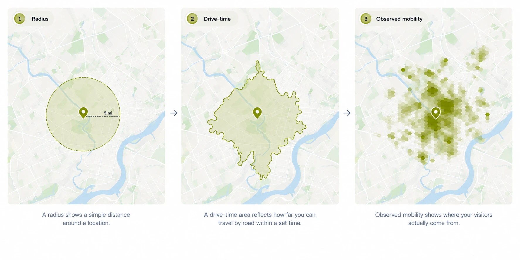
1. Buffer or radius
The simplest method uses a fixed-distance radius around a location. For example, everything within five kilometers might be treated as part of the catchment.
This approach is easy to calculate and useful for high-level estimates, but it assumes that distance affects accessibility equally in every direction. It does not account for road networks, geographic barriers, transportation options, or actual visitor behavior.
2. Drive-time or walk-time
Travel-time catchments use the surrounding transportation network to define which areas can be reached within a given period, such as a 10-minute drive or a 15-minute walk.
The resulting boundary reflects accessibility more realistically than a fixed radius because it accounts for the structure of roads and paths.
However, it still represents potential accessibility. It shows where people could reasonably travel from, rather than where visitors actually originate.
3. Mobility-based
A mobility-based approach derives the catchment from observed visitation and movement patterns rather than a predefined geographic boundary.
Aggregated location signals can be used to understand the areas associated with visitors to a location. This can reveal patterns that geometric models do not capture, such as workplace-driven visitation, commuting behavior, or catchments that extend along particular transport corridors.
Unlike radius and travel-time methods, this approach derives geographic reach from observed mobility patterns rather than accessibility alone. Its main requirement is access to reliable mobility data.
| Method | How it works | Main limitation |
|---|---|---|
| Buffer / radius | Fixed-distance boundary around a location | Does not account for accessibility or behavior |
| Drive-time / walk-time | Boundary based on travel time through a transport network | Represents potential rather than observed visitation |
| Mobility-based | Geographic distribution derived from observed mobility patterns | Requires reliable mobility data |
How Pine59 supports catchment area analysis
Pine59 Trade Area (opens in a new tab) provides a data-driven view of visitor origins based on observed mobility patterns rather than a predefined geographic boundary.
Visitors are attributed to inferred home and work areas, with each origin area reported as a share of the location's visits. Home and work origins are analyzed separately, helping distinguish residential patterns from those associated with workplaces and commuting.
Privacy thresholds, geographic resolution, methodology, coverage, and update cadence vary by dataset and market and should be considered when interpreting results.
Catchment-related analysis in Pine59 can be applied to individual Places (opens in a new tab) as well as bounded geographic Areas (opens in a new tab). Metrics can also be attributed to custom geographic boundaries, such as trade zones, property outlines, or existing catchment polygons.
Trade Area answers the core catchment question: where are visitors coming from? Other Pine59 datasets add context:
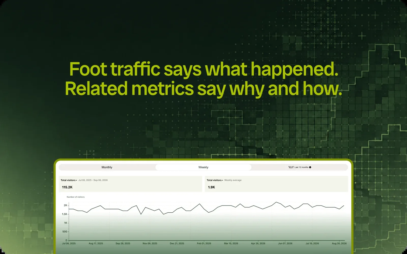
- Foot Traffic (opens in a new tab) measures visit volume.
- Visitor Demographics (opens in a new tab) describes the demographic composition of visitors, while Visitor Profile (opens in a new tab) describes their lifestyle and interest profiles.
- Visitor Journey (opens in a new tab) shows where visitors go before and after a location.
Together, these datasets provide a broader view of where visitors come from, how much visitation a location receives, who those visitors are, and how they move.
Coverage and available metrics vary by dataset and market. Current availability can be found in the dataset documentation (opens in a new tab).
See what catchment analysis could reveal about your locations
“A radius can tell you what is nearby. A drive-time model can tell you what is accessible. Mobility data can show you the geographic patterns behind actual visitation.”
With Pine59, you can go beyond assumed boundaries to understand where visitors come from, how much visitation a location receives, who those visitors are, and how they move between places.
Explore the data visually in Pine59 Insights, or access Pine59 datasets through the API to use location intelligence in your own models, products, and workflows.
Want to see how this could work for your locations, markets, or use case?




Turn aggregated location intelligence into competitive advantage
Discover how Pine59 can power your analytics, products and AI with statistical insights about places and populations.